This scale provides detail for the really committed navigator and map enthusiast. Studying the country down to its every wall and ditch gives real confidence in route finding and satisfaction in "reading" the landscape. To follow your route at 1:25,000 you will need Outdoor Explorer maps OL45, 179, 168, 167 and 155.
| |
|
These maps are available in three editions:
Paper - they fold well, and are backed with a reasonably durable laminated cover. They will remain intact, depending on how much wind and rain you have encountered!
Wilderness - laminated, tear resistant and waterproof they are designed for use in wind and rain and should arrive home with you as a permanent souvenir.
Lam-Fold - extra strong lamination with a 'china-graph' write-on, wipe-off surface they are also tear resistant and waterproof. They are however, a little bulkier than the 'wilderness' version.
|
| |
|
Cotswold-Way Suggestions |

|
|
The Wilderness Edition maps are a good compromise between the paper maps that are likely to self-destruct in the wind, rain, sleet & snow and the
heavier duty Lam-Fold Editions.
|
|
|
| |
|
Map OL45: The Cotswolds
|
click to enlarge
|
1:25,000; 2.5 inches to 1 mile; 4cm to 1km
Dimensions: 225 mm x 135 mm
|
|
|
|
|
|
Map OL179: Gloucester, Cheltenham & Stroud
|
click to enlarge
|
1:25,000; 2.5 inches to 1 mile; 4cm to 1km
Dimensions: 225 mm x 135 mm
|
|
|
|
|
|
Map OL168: Stroud, Tetbury & Malmesbury
|
click to enlarge
|
1:25,000; 2.5 inches to 1 mile; 4cm to 1km
Dimensions: 225 mm x 135 mm
|
|
|
|
|
|
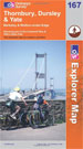
Map OL167: Thornbury, Dursley & Yate
|
click to enlarge
|
1:25,000; 2.5 inches to 1 mile; 4cm to 1km
Dimensions: 225 mm x 135 mm
|
|
|
|
|
|
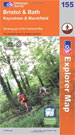
Map OL155: Bristol & Bath
|
click to enlarge
|
1:25,000; 2.5 inches to 1 mile; 4cm to 1km
Dimensions: 225 mm x 135 mm
|
|
|
|
|
|
|
| |
Ordnance Survey Landranger Maps

|
|
Scale 1:50,000; 2cm to 1km; 1� inches to 1 mile
If you use the 1:50,000 Ordnance Survey Landranger maps you will need Sheets 150, 151, 162, 163 and 172. The Cotswold Way is clearly marked as a trail of red diamond shapes.
1:50,000 is an appropriate scale for a walk such as this one, much of which is along the escarpment. Consultation with the map will help you appreciate the views of wide areas of countryside and towns
|
| |
|
These maps are available in three editions:
Paper - they fold well, and are backed with a reasonably durable laminated cover. They will remain intact, depending on how much wind and rain you have encountered!
Wilderness - laminated, tear resistant and waterproof they are designed for use in wind and rain and should arrive home with you as a permanent souvenir.
Lam-Fold - extra strong lamination with a 'china-graph' write-on, wipe-off surface they are also tear resistant and waterproof. They are however, a little bulkier than the 'wilderness' version.
|
| |
|
Cotswold-Way Suggestions
|
|
|
The Wilderness Edition maps are a good compromise between the paper maps that are likely to self-destruct in the wind, rain, sleet & snow and the
heavier duty Lam-Fold Editions.
|
|
|
| |
|
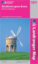
Map 151: Stratford-Upon-Avon. Warwick & Banbury
|
click to enlarge
|
1:50,000; 2cm to 1km; 1.25 inches to 1 mile
Dimensions: 225 mm x 135 mm
|
|
|
|
|
|
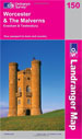
Map 150: Worcester & the Malverns
|
click to enlarge
|
1:50,000; 2cm to 1km; 1.25 inches to 1 mile
Dimensions: 225 mm x 135 mm
|
|
|
|
|
|
Map 163: Cheltenham & Circencester
|
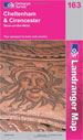
click to enlarge
|
1:50,000; 2cm to 1km; 1.25 inches to 1 mile
Dimensions: 225 mm x 135 mm
|
|
|
|
|
|
Map 162: Gloucester & Forest of Dean
|
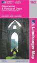
click to enlarge
|
1:50,000; 2cm to 1km; 1.25 inches to 1 mile
Dimensions: 225 mm x 135 mm
|
|
|
|
|
|
Map 172: Bristol & Bath
|
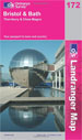
click to enlarge
|
1:50,000; 2cm to 1km; 1.25 inches to 1 mile
Dimensions: 225 mm x 135 mm
|
|
|
|
|
|
Cotswold-Way Suggestions
|
|
|
Your choice of maps is complicated. It is dependant upon your preferred choice of scale, publisher and pocket!
Our recommendation is that you use the Harvey map for route-finding but take along an accompanying style of OS map to spread out to savour the view and survey the landscape and line up the hilltops.
|
|
|
| |